
MOD Info
The Handy GPS app is a powerful and user-friendly navigation tool that allows you to easily navigate and track your location using GPS technology. With features like offline maps, waypoints, and route planning, you can confidently explore new places even without an internet connection . The app also offers various map styles, customizable markers, and the ability to share your location with friends. Whether you're hiking in the mountains, traveling in a new city, or simply exploring your own neighborhood, Handy GPS is the perfect app to help you find your way.
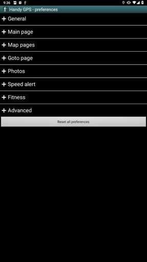
Software features
No ads, no subscriptions, no fees to pay after the initial purchase.
Unlimited number of waypoints and track recording points.
Send your location as a clickable map link to friends via email or text message.
Email your waypoint and track logs as KML or GPX files.
Common benchmarks such as NAD83 (US), OSGB36 (UK), NZTM2000 (New Zealand), SAD69 (South America) and ED50 (Europe) are supported, and you can configure your own custom benchmarks, including local grid systems.
If you select OSGB data, you can display the UK grid reference with a two-letter prefix.
Elevation profile.
GPS averaging mode.
Take photos and record voice memos, geolocated using KML files for easy viewing on your PC.
Geotag photos, and/or "burn" coordinates and orientation into images.
Sunrise and sunset times.
Export data to CSV file.
Create waypoints by triangulation or projection using the entered distance and bearing.
Calculate the length, area, and elevation change of a track record.
Support offline maps by downloading tiles from a map tile server or using your own map image.
Count calories.
Optional background image.
Optional network location sharing.
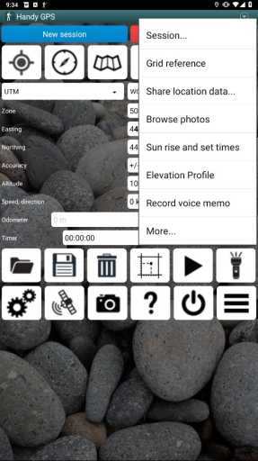
Go to the page with spoken distance and direction guidance.
Software Highlights
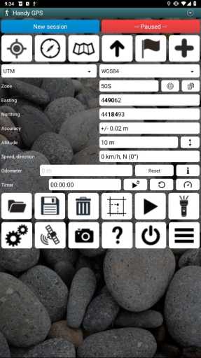
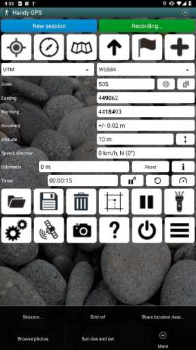
Displays your current coordinates, altitude, speed, direction of travel and distance traveled in metric, imperial/US or nautical units.
Your current location can be stored as a waypoint and a track log recorded to show where you've been on a map.
Data can be imported and exported from KML and GPX files.
Allows manual entry of waypoints in UTM, MGRS and latitude/longitude coordinates.
You can use the Goto screen to guide you to waypoints, with the option to sound an alert as you approach.
There is a compass page for devices with magnetic field sensors.
Automatically calculates local geoid offsets to improve height accuracy
Supports global WGS84 datums as well as common Australian datums and map grids (AGD66, AGD84, AMG, GDA94 and MGA). You can also get NAD83 maps using WGS84 in the United States.
Graphically displays GPS satellite positions and signal strength.
Can display simple or MGRS grid references.
The distance and direction from waypoint to waypoint can be calculated.
Includes optional timer cord for recording walk duration and calculating your average speed.
The developers carried out thorough testing on many Nordic walks
Similar Apps


 Xmind mod apk premium unlocked download")
 Navier HUD mod apk premium unlocked download")

 UNFOLD mod apk premium unlocked download")
 Fabulous mod apk premium unlocked download")
 Widgetable mod apk premium unlocked latest version download")
 Flowx mod apk premium unlocked download")