
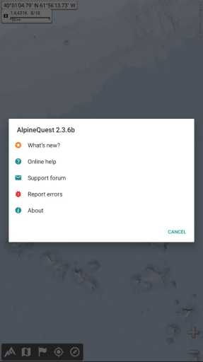
MOD Info
AlpineQuest Off-Road Explorer Pro is a practical application designed for outdoor adventurers. It turns your smartphone or tablet into a powerful GPS navigation device to help you explore and navigate in remote areas. The application has offline maps, navigation, track recording, route planning and other functions, and supports multiple map sources, including OpenStreetMap and Google Maps. You can use the app without an internet connection and track your location and navigation route at any time.
Software features
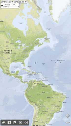
map
Built-in online maps (can be automatically stored locally, including roads, topographic maps and satellite maps) and online layers (road names, hillshades, contours);
Get more online maps and layers (all major world maps and many local topographic maps) with one click from the included list of community maps;
Complete regional storage and use online maps offline;
Onboard offline map support (raster) including KMZ overlays, OziExplorer OZFx2, GeoPackage GeoPkg, MbTile, SqliteDB and TMS compressed tiles (visit our website for MOBAC, free map creator);
Quickly create charts with memory mapping support (only .qct mapping, .qc3 mapping is not compatible);
Digital elevation model on-board storage (1 arc second SRTM DEM) and support for HGT elevation files (including 1 arc second and 3 arc second resolution) allowing display of terrain, hillshades and steep slopes;
Multiple map layer display, with opacity control for each map;
Advanced SD memory card map explorer.
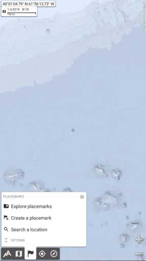
landmark
Create, display, save, restore an unlimited number of items (waypoints, routes, areas and tracks);
Import/export GPX files, Google Earth KML/KMZ files, and CSV/TSV files:
Import ShapeFile SHP/PRJ/DBF, OziExplorer WPT/PLT, Geocaching LOC waypoints and export AutoCAD DXF files:
Save and share your online location with other users using community landmarks;
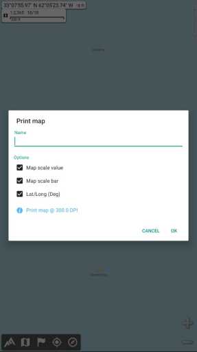
Detailed information, advanced statistics and interactive graphics about various projects;
The time controller marks the track with the playback time;
Route, track and area creator;
Advanced SD memory card landmark explorer.
GPS positioning/orientation
Use GPS or the Internet to perform geolocation on a map;
Map orientation, compass and target finder;
Built-in GPS/barometric pressure logger (long-term tracking capability, runs in a separate lightweight process);
Proximity alert and off-path alert;
Barometer support (for compatible devices).
Software Highlights
Use offline terrain maps to turn your Android device into a real off-road GPS!
No ads ~ no data monetization ~ no analytics ~ no third-party libraries
AlpineQuest is the complete solution for all outdoor activities and sports, including hiking, running, geocaching, hunting, sailing, geography work, off-road navigation and more.
You can access and store a large number of online terrain maps locally and they will remain available even when outside cellular network coverage. AlpineQuest also supports airborne file maps, such as QCT or OZFx2 maps.
By using GPS and the device's magnetic sensor (with compass display), getting lost is a thing of the past: you can be positioned in real time on a map, which can also be oriented to match the location you are looking at.
Save and retrieve placemarks, and share them with your friends. Track your path, get advanced statistics and interactive graphs. You'll never have any doubts about what you can accomplish.
By remaining fully operational outside of cellular coverage (often in the mountains or abroad), AlpineQuest helps you satisfy all your cravings for deep wilderness exploration.
Function menu
This menu appears at the bottom of the screen and provides access to all of the app's features and tools. They are divided into five main categories, each with a menu button:
1. Application related functions, such as custom menu buttons, settings, etc.;
2. Maps and layers: list available maps, change maps, etc.;
3. Landmarks: Save and retrieve landmarks, such as waypoints, search locations, etc.;
4. Positioning: display/hide GPS real-time location, record track, etc. on the map;
5. Direction: Display compass and get direction information.

you can:
Clicking a menu button displays its submenu, which lists the main functions of that function;
Double-click a menu button to display its submenu, expand it to display all options;
A long press of the menu button calls up the main functions of the submenu. For example, long pressing the first menu button shrinks the function menu.
Similar Apps


 Soul Browser mod apk latest version no ads download")

 SmartTube Next Beta latest version download")
 Flixoid mod app no ads download")
 Muso Player mod apk premium unlocked download")

 Real Pads mod apk premium unlocked download")